Vehicle crime in Stockton-on-Tees: the streets to know about
Police recorded 389 vehicle crimes within a mile of Stockton-on-Tees town centre in the last 12 months — theft of vehicles, theft from vehicles and vehicle interference.
The short answer
Stockton-on-Tees ranks #26 of 111 UK town centres we track for vehicle crime, with 389 offences in 12 months — though falling. Parking here isn’t reckless, but it rewards care: most offences cluster on a handful of streets (named below), and most are opportunist — visible deterrents end them.
389
Vehicle crimes, September 2025 – August 2026
-16%
Last 3 months vs the same 3 months a year earlier
32
Average per month
Rate per 1,000 residents · year ending June 2026
Vehicle crime across the Cleveland force area
5.85
per 1,000 people, Cleveland
5.04
England and Wales
3,508
offences recorded, 12 months
Vehicle crime in the Cleveland force area runs at about 1.2 times the national rate. Stockton-on-Tees is one of the local authority areas inside it.
This is a different measure from the count above. The 389 figure counts crimes within a mile of Stockton-on-Tees town centre, from police street-level records. The rate here covers the whole Cleveland force area, from police recorded crime as published by ONS. Different geography and a different collection basis, so the two totals are not comparable with each other.
Source: Office for National Statistics, Crime in England and Wales: Police Force Area data tables, year ending June 2026. Police recorded crime collected by the Home Office. How we use it. Published under the Open Government Licence v3.0.
The last 12 months
Where it clusters in Stockton-on-Tees
| # | Street (on or near) | Vehicle crimes (15 months) |
|---|---|---|
| 1 | Loweswater Crescent | 7 |
| 2 | Wasdale Grove | 7 |
| 3 | Belmont Avenue | 7 |
| 4 | Marina Way | 7 |
| 5 | Commondale Avenue | 6 |
| 6 | Timothy Court | 6 |
| 7 | Chatsworth Court | 5 |
| 8 | Weardale Place | 5 |
| 9 | Hartington Road | 5 |
| 10 | Stainmore Close | 5 |
What to do with this: if you regularly park on or near the streets above, that’s where the defences below earn their keep — most of these offences are opportunist, and the easiest car on the street is the one taken. Check your insurance excess too: it’s often more than the cost of every deterrent combined.
Figures are street-level police records within one mile of Stockton-on-Tees town centre — police anonymise locations to the nearest mapped street point, so counts are indicative of the immediate area rather than exact addresses. Compare Stockton-on-Tees with other towns on the UK vehicle crime league table, or check the roads themselves on the Stockton-on-Tees accident hotspot map.
How Stockton-on-Tees compares nationally
Stockton-on-Tees is the highway authority for these roads, which means the same body counted in the national comparison below is the one that maintains them.
Per mile driven
165 of 192
Per resident
167 of 188
Risk band
Below average
Five-year trend
down 25.9%
The full record for Stockton-on-Tees — severity-adjusted casualties, the breakdown of who is being hurt, the darkness and ice profile, and a comparison against its ONS statistical neighbours rather than the national average — is on its own page.
Stockton-on-Tees’s full road risk record →What actually changes the odds in Stockton-on-Tees
Data is only useful if it changes what you do. These three are picked from Stockton-on-Tees’s own figures above, each with the number that prompted it. Every guide explains how the thing works before it suggests buying anything, and most cost less than a third of a typical insurance excess.
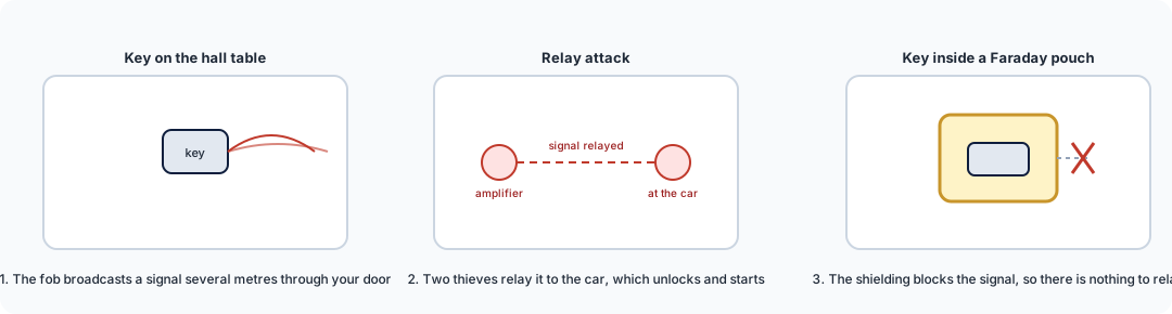
Faraday key pouch / box
£9–£25
Stockton-on-Tees records 458 vehicle crimes per 100,000 residents, above the median of the towns we track. Keyless relay theft is the leading route into modern cars, and a signal-blocking pouch ends that method outright for under a tenner.
How it works →
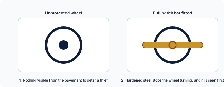
Steering wheel lock
£40–£70
Vehicle theft is target selection: thieves work a street and take the easiest car. A visible attack-rated bar moves your car down that list before anyone touches it.
How it works →
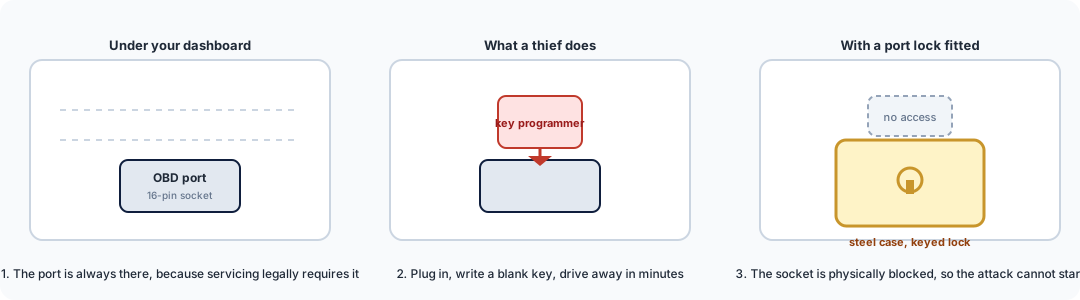
OBD port lock
£25–£50
Where theft rates run above average, key-cloning through the diagnostic socket tends to follow. A £25 steel case blocks the socket the programmer needs.
How it works →
We are a data business, not a retailer: these link to our guides, which link on to retailers. Some of those links earn us a small commission at no cost to you, and we hold no stock and take no payment for placement. All security guides.
Related on Swift Assist
Need this data for your own work?
Site and junction reports from £95, next working day. Free for community groups, campaigners and journalists.