Road risk in Norfolk
Norfolk ranks 47 of 192 British highway authorities on our road risk score. Here is what the official record shows, and how it compares.
Police recorded 1,721 injury collisions in Norfolk in 2025, hurting 2,254 people, of whom 522 were killed or seriously injured and 29 were killed. Set against the traffic its roads actually carry, that is 95 killed or seriously injured per billion vehicle miles, 18% above the median ranked authority (80.5).
- Collisions
- 1,721 in 2025
- People hurt
- 2,254 casualties
- Killed or seriously injured
- 522
- Killed
- 29
- KSI per billion vehicle miles
- 95 (median 80.5)
- KSI, three-year average
- 478.6 a year
- Severity-adjusted KSI, 2025
- 592 (recorded: 522)
- Severity-adjusted KSI, three-year average
- 536.4 a year (recorded: 478.6)
- KSI per 100,000 residents
- 55.2 — rank 15
- Population
- 945,427
- Risk score
- 62.2/100 — rank 47 of 192
Compiled by Stephen Hall, Data lead, Swift Assist. Source: DfT STATS19 and DfT road traffic estimates (2025), OGL v3. Updated 2026-10-08.
Five years of collisions in Norfolk
Across 2021–2025, recorded collisions were up 25.2%, with 2025 the worst year of the period at 1,721 collisions.
Collisions per year in Norfolk
2025: 1,721 (up 5.7% on the year before) · peak 1,721 in 2025 · +25.2% across the period
Axis clipped to the data range to show year-on-year movement.
Norfolk looks less dangerous per mile driven than per resident
Divide casualties by the people who live here and Norfolk ranks 15. Divide by the miles actually driven on its roads and it ranks 47 — a difference of 32 places.
That gap runs the other way: relative to the traffic its roads carry, Norfolk does less harm than its casualty count per resident implies. Places with heavy local travel and few through routes tend to look worse per head than the volume of driving warrants. Neither number is the true one. Which you should use depends on whether you are asking how safe it is to live somewhere or how safe it is to drive there.
Pedestrians, cyclists and riders in Norfolk
These are the road users with the least protection when something goes wrong, and they carry a disproportionate share of the serious injuries. Across 1,721 collisions in Norfolk, the three groups appear 745 times between them — an involvement rate of 43.3%.
| Road user | Collisions | Share of all collisions |
|---|---|---|
| Pedestrians | 237 | 13.8% |
| Cyclists | 220 | 12.8% |
| Motorcyclists | 288 | 16.7% |
A single collision can involve more than one of these groups and is then counted in each row, so the rows do not add up to a share of the total.
When collisions happen in Norfolk
DfT records the light level and road surface at every collision, but publishes neither below national level. These are Norfolk’s own shares over 4,703 collisions, with the national figure beside each one for comparison.
| Share of collisions | Norfolk | National | How it reads |
|---|---|---|---|
| In darknessAny collision where the officer recorded darkness, lit or unlit. | 25% | 28.7% | below the national figure |
| In darkness, no street lightingThe rural lighting picture rather than the urban speeding one. | 11.8% | 6.3% | roughly double the national figure |
| On a wet road surfaceWet, damp or standing water at the scene. | 27.3% | 24.5% | above the national figure |
| On snow or iceRare everywhere, and concentrated in a handful of authorities. | 2.1% | 1.4% | well above the national figure |
On the darkness share, Norfolk ranks 157 of 192 authorities, counting from the highest.
The winter effect. Collisions in Norfolk run 5.6% lower from November to January than from May to July — against 4.5% lower nationally. That is 1,154 collisions against 1,222.
What this does not tell you
- A share is not a rate. A high darkness share means darkness accounts for more of Norfolk’s collisions — not that its roads are more dangerous overall. Read it alongside the casualties-per-mile-driven figure above.
- Condition is recorded, not tested. The officer records the surface and light level at the scene. It is an observation, not a measurement, and it is not a finding that the condition caused the collision.
- Exposure is not controlled for. Fewer people travel at 3am than at 3pm, so a collision in darkness is drawn from a smaller pool of journeys. Without hourly traffic counts, these shares describe when collisions happen rather than how risky an hour is.
Every authority compared on the same measures: winter road risk across Britain.
Where the casualties fall across Norfolk’s districts
Norfolk is the highway authority, but the collisions are spread unevenly across the 7 districts within it.
| District | Collisions | Casualties | KSI |
|---|---|---|---|
| South Norfolk | 311 | 428 | 96 |
| Norwich | 298 | 334 | 76 |
| Breckland | 297 | 402 | 93 |
| King's Lynn and West Norfolk | 277 | 359 | 89 |
| Broadland | 240 | 319 | 78 |
| Great Yarmouth | 174 | 224 | 42 |
| North Norfolk | 124 | 188 | 48 |
Norfolk against similar authorities
ONS does name statistical neighbours for Norfolk, but most of them are lower-tier districts that we do not publish as authority pages — they are not highway authorities, so their road figures belong to the county above them. Rather than compare against pages that do not exist, these are the authorities nearest to Norfolk in the national table. That is a weaker comparison and we would rather say so than imply a like-for-like match we cannot actually make. Within this group Norfolk is 16 of 21 on casualties per mile driven, against a group median of 123.9.
| Authority | KSI / bn miles | Score | National rank |
|---|---|---|---|
| Bristol, City of | 158 | 62 | 48 |
| Ealing | 156.1 | 62.6 | 45 |
| Sutton | 152.8 | 61.9 | 50 |
| Pembrokeshire | 151.3 | 63.2 | 43 |
| Waltham Forest | 146.7 | 62.3 | 46 |
| Barking and Dagenham | 144.1 | 61.4 | 51 |
| Glasgow City | 107.7 | 63 | 44 |
| Norfolk (this page) | 95 | 62.2 | 47 |
| York | 90.5 | 61.9 | 49 |
Norfolk against its closest comparators
Norfolk sits 47 of 192 nationally, and 43 of 148 within England. These are the authorities nearest to it in the table.
| # | Authority | Score | KSI / bn miles |
|---|---|---|---|
| 45 | Ealing | 62.6 | 156.1 |
| 46 | Waltham Forest | 62.3 | 146.7 |
| 47 | Norfolk (this page) | 62.2 | 95 |
| 48 | Bristol, City of | 62 | 158 |
| 49 | York | 61.9 | 90.5 |
Road risk in Norfolk, answered
How dangerous are the roads in Norfolk?
In the latest official DfT figures, 1,721 road collisions in Norfolk injured or killed 2,254 people, 522 of them killed or seriously injured. Measured against the traffic its roads actually carry, that is 95 people killed or seriously injured per billion vehicle miles, against a median of 80.5 across the ranked authorities — placing Norfolk 47 of 192 authorities on our combined score, where 1 is the highest risk. The score weighs that rate alongside who is being hurt, the five-year trend and how often a serious collision proves fatal, so the rank is not the rate alone.
Are road casualties in Norfolk rising or falling?
Across 2021–2025, recorded collisions in Norfolk were up 25.2%, with 2025 the worst year of the period at 1,721 collisions. Year-to-year movement in a single authority is noisy, so the five-year direction carries more than any single year's change.
Who is being hurt on Norfolk's roads?
In Norfolk there were 237 collisions involving pedestrians, 220 involving cyclists and 288 involving motorcyclists, out of 1,721 in total. Added together that is an involvement rate of 43.3%, though a collision involving two of those groups is counted in both figures, so it is a comparable index rather than a clean share.
Who is responsible for road safety in Norfolk?
Norfolk is a county council, and is the highway authority for its own roads. That means it sets local speed limits, designs junctions and crossings, and decides safety scheme spending. Motorways and most trunk roads are managed separately by National Highways in England, Transport Scotland, or the Welsh Government, so the worst road in an area is often not the council's to change. Enforcement sits with the local police force.
Where does this data come from?
DfT STATS19, the record police complete at the scene of every injury collision, published annually under the Open Government Licence, combined with DfT's own road traffic estimates for the mileage denominator. Collision, casualty and KSI counts on this page are for 2025; only the trend compares 2021–2025. STATS19 counts collisions police attended and recorded, so collisions never reported do not appear, and under-reporting is known to be worst for cyclists and for slight injuries.
What actually changes the odds in Norfolk
Data is only useful if it changes what you do. These three are picked from Norfolk’s own figures above, each with the number that prompted it. Every guide explains how the thing works before it suggests buying anything, and most cost less than a third of a typical insurance excess.
Alarmed disc lock
£20–£50
Motorcyclists are in 17% of Norfolk's collisions, and bikes are also lifted rather than ridden away. An alarmed disc lock covers the theft half for about £30.
How it works →
Dashcam (parking mode)
£50–£150
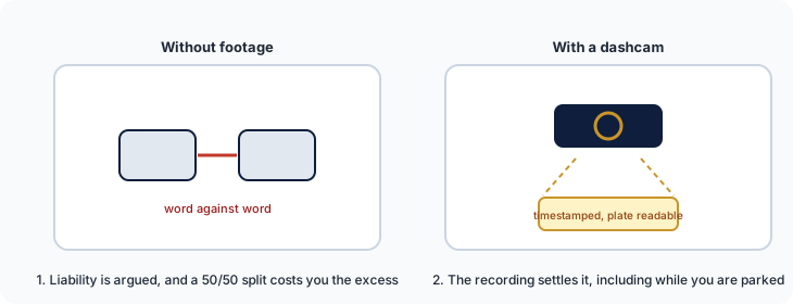
Collisions in Norfolk are up 25% across the period. A dashcam with parking mode is the cheapest way to keep a disputed claim from becoming a 50/50 split.
How it works →
We are a data business, not a retailer: these link to our guides, which link on to retailers. Some of those links earn us a small commission at no cost to you, and we hold no stock and take no payment for placement. All security guides.
More on Norfolk and UK road risk
All 192 British authorities ranked
The full sortable league table, with the method behind it.
Read more →Blackspots that were never fixed
Sites with injury collisions in every one of the last five years.
Read more →UK road risk: the national picture
What the official record says about Britain's roads overall.
Read more →Need this cut differently?
Custom analysis by ward, corridor or junction. Free for campaigns and press.
Read more →Free API
Pull these figures programmatically, with provenance on every endpoint.
Read more →